


Details
Description
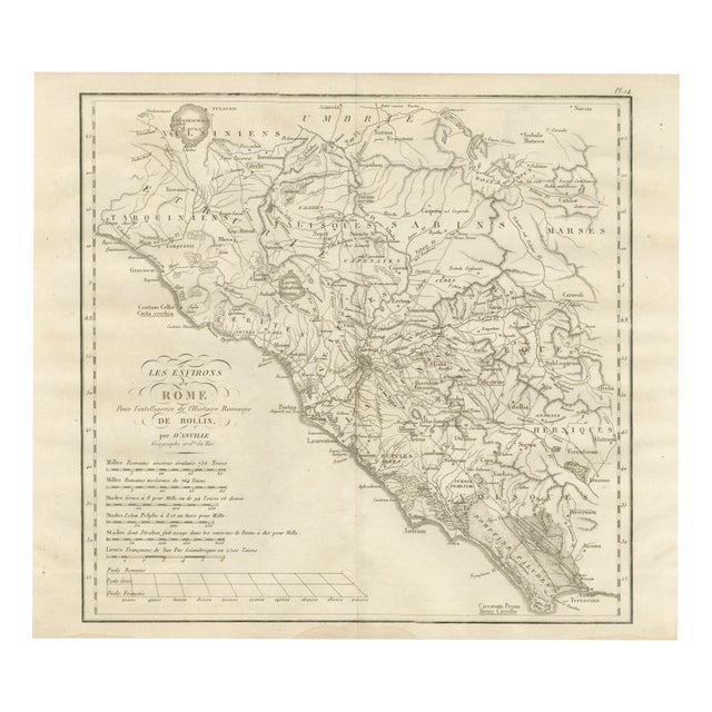
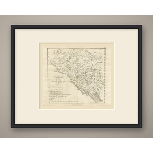
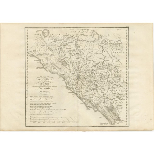
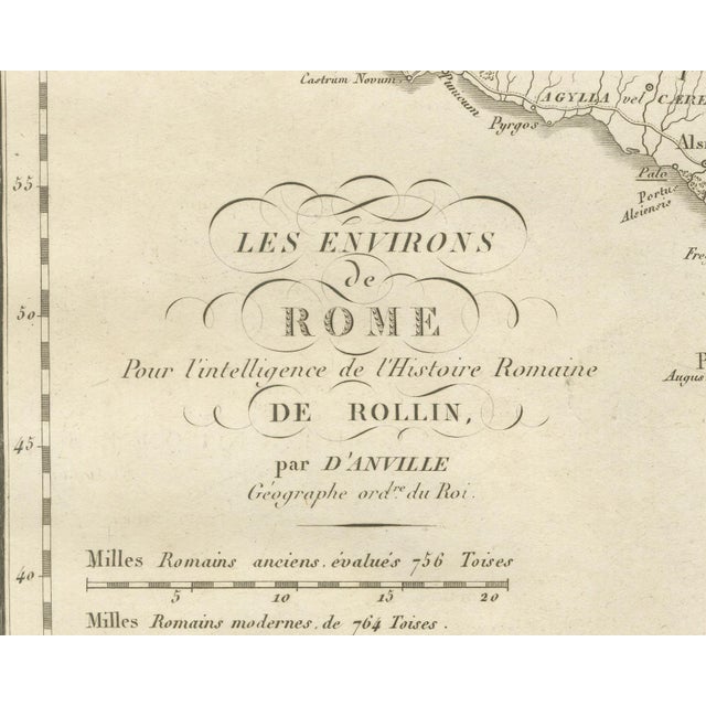
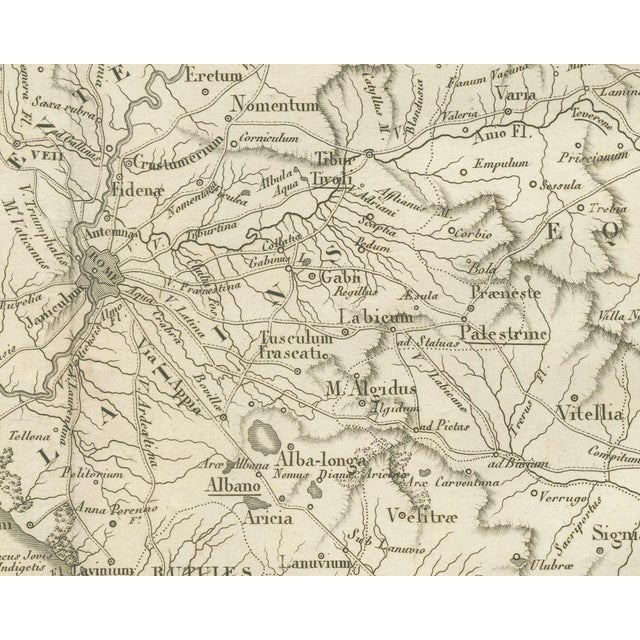
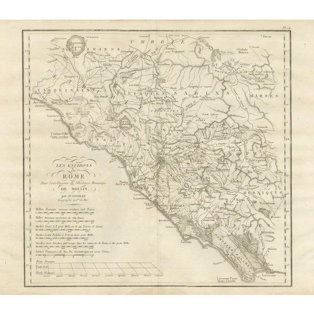
An original copper engraved map, uncolored, of the country around ancient Rome. It runs from Vulsinii and its lake in … Read more An original copper engraved map, uncolored, of the country around ancient Rome. It runs from Vulsinii and its lake in the north to Terracina and the Circaeum Prom. in the south, and from the Tyrrhenian coast inland to the Apennines. The peoples are lettered in French across it, among them the Volsques, Herniques, Eques, Rutules, Falisques and Capenates, with Etrurie to the northwest. Rome stands at the center on the Tiber, with Veii, Fidenae, Tibur, Praeneste, Tusculum, Gabii, Alba-longa, Aricia, Lavinium, Ardea, Ostia and Antium around it, and the Pomptinae Paludes to the south. The roads are drawn and named, including the Via Appia, Latina, Praenestina, Tiburtina, Aurelia, Cassia, Flaminia and Valeria. Modern names such as Tivoli, Frascati and Albano are underlined beside the ancient ones. The cartouche reads Les Environs de Rome pour l'intelligence de l'Histoire Romaine de Rollin, par d'Anville, Géographe ord. re du Roi. The plate is numbered Pl. 14 above the upper right corner of the border. Six scale bars stand below it, from Milles Romains anciens, évalués 756 Toises and Milles Romains modernes, de 764 Toises through Greek stades, the stades of Polybius and of Strabo, to the French league, with a ruled comparison of Pieds Romains, Pieds Grecs and Pieds Français. A light center fold runs through the double sheet. The plate comes from the Atlas de Géographie Ancienne, published in Paris in 1818 by Ledoux et Tenré and printed by Didot le jeune to accompany the works of Charles Rollin (1661 to 1741), the French historian, author of the Histoire ancienne and the Histoire romaine. Its maps are engraved after the originals of Jean-Baptiste Bourguignon d'Anville (1697 to 1782). In the foreword, signed by Ambroise Tardieu, géographe-graveur, Tardieu writes that the maps were copied with religious fidelity and that, charged with reviewing the proofs, he corrected only negligences and faults of execution. The map serves the opening books of Rollin's Roman history, when Rome fought its neighbors in Latium and southern Etruria. Condition: Light uneven toning, browner toward the edges. Marked handling soiling along all four edges. Foxing over much of the margin. Slight wear at the bottom right and top right corners. Minor edge wear, shallow nicks along the right. A pale brown tide line runs along the lower margin. This is an original antique map, not a modern reproduction. This item is sold unframed. Any framed or interior images are shown for presentation and inspiration only, unless the listing explicitly states that the item is sold framed. See less
- Dimensions
- 19.69ʺW × 13.78ʺH
- Period
- 19th Century
- Country of Origin
- France
- Item Type
- Vintage, Antique or Pre-owned
- Materials
- Paper
- Condition
- Good Condition, Unknown, Some Imperfections
- Color
- Brown
- Condition Notes
- Very Good — This vintage item has no defects, but it may show slight traces of use\. Uneven toning, browner … moreVery Good — This vintage item has no defects, but it may show slight traces of use\. Uneven toning, browner at the edges. Marked handling soiling along all four edges. Foxing in much of the margin. Slight wear at the bottom right and top right corners. Shallow nicks along the right. Tide line in the lower margin. less
Returns & Cancellations
Return Policy - All sales are final 48 hours after delivery, unless otherwise specified in the description of the product.
Cancellation Policy - Prior to shipping or local pickup, buyers may cancel an order for up to 48 hours, unless otherwise specified.